Japan publicizes map proving its sovereignty over Senkaku
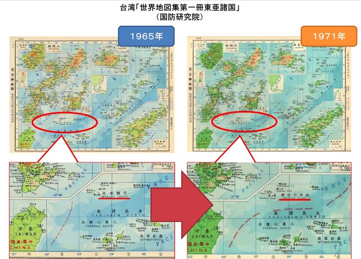
A screenshot of a PDF uploaded to the Foreign Ministry site highlights the difference between two maps of the Senkaku Islands. Source: japantimes.co.jp
(VOVworld) – Japan’s Foreign Ministry has published on its website a map released by a Chinese government organ in 1969 calling the disputed Senkaku Islands by their Japanese name. According to Japan’s news agency Kyodo, the map, created by the Chinese State Bureau of Surveying and Mapping in 1969, labels the uninhabited islets with Chinese characters that read “Senkaku Islands.” This is Japan’s latest evidence showing that both Japan and its neighbors have historically considered the island group in the East China Sea to be Japanese territory. Senkaku is currently under Japan’s control but is also claimed by China under the name Diaoyu.