More evidence of Vietnam’s sovereignty over Hoang Sa and Truong Sa archipelagoes
(VOVworld) - The Ministry of Information and Communications has received the World Altas published in Brussels in the 19th century confirming Vietnam’s undeniable sovereignty over the Paracel and Spratly archipelagoes.
.jpg) |
The map collection was drawn by French geographer Philippe Vandermaelen and published in 1827. This was the first map collection depicting with pinpoint accuracy the position and geographical characters plus the Western names of major islands in Hoang Sa (Paracel) archipelago.
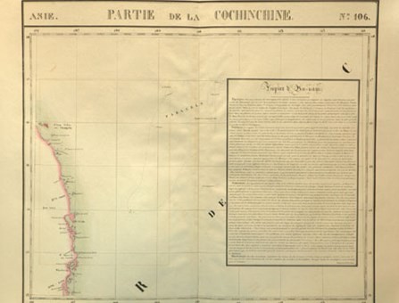
The “Partie de la Cochichine”, an atlas by Belgian geographer Philippe Vandermaelen (1795-1869)
|
The map clearly indicates that the Hoang Sa (Paracel) islands are part of Vietnam
|
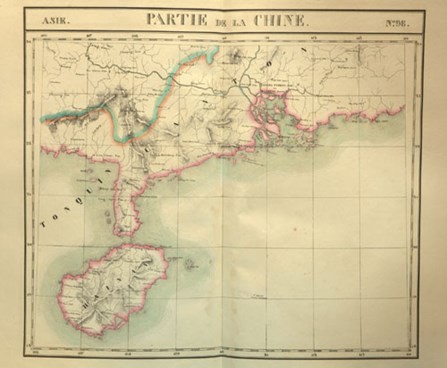
The Atlas has 111 depictions of Asian countries clearly depicting China’s southernmost territory of Hainan island not further than 18 degrees of longitude. Minister of Information and Communications Nguyen Bac Son was speaking at the event on Tuesday:
“Vietnam has sufficient legal and historical evidence confirming its national sovereignty, jurisdictional and territorial rights over its special economic zone and continental shelf adhering to regulations of the 1982 UN Convention on the Law of the Sea. The Altas that we have received once again reinforce our indisputable sovereignty over the two archipelagoes. The Ministry will join other agencies in the collection and appraisal of any documents defining Vietnam’s national sovereignty over Hoang Sa Paracel and Truong Sa Spratly archipelagoes.”
.jpg) |