(VOVWORLD) - Major Le Thi Minh Thuy of the Vietnamese Navy and her colleagues have drawn hundreds of digital nautical charts and seabed topographic maps, and built geographic databases. This work, which helps to protect the sovereignty of Vietnam’s sea and islands, requires meticulous accuracy.
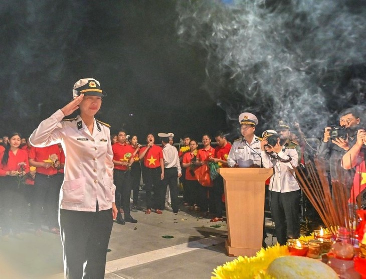 Major Le Thi Minh Thuy during her trip to Truong Sa in May 2023. (Photo: VOV) Major Le Thi Minh Thuy during her trip to Truong Sa in May 2023. (Photo: VOV) |
Last May, 35 years after her father, martyr Le Dinh Tho, died in the line of duty there, Major Thuy took a trip to Truong Sa (Spratly), finally realizing her dream to visit the archipelago and burn incense for her father and his 63 comrades.
“In Truong Sa I had a feeling that’s hard to describe. I wanted to tell my father and other fallen soldiers that my colleagues and I will continue to follow their aspirations and dreams,” said Thuy.
Thuy’s father died when she was 1 year old. At the time he was working for the Division of Nautical Chart Surveying and Drawing and Marine Research. Several months later, Thuy suffered the death of her mother. Thuy was raised by her relatives and her father’s colleagues.
After graduating from the University of Mining and Geology where she majored in surveying and mapping, Thuy started working for the Division of Nautical Chart Surveying and Drawing and Marine Research to continue her father’s dreams.
During her Truong Sa trip, in addition to visiting the place where her father served, Thuy inspected embankments, coral reefs, and the color of the sea water at different depths, which is valuable experience for her work.
Thuy said she always tries to process and present data collected in the most accurate way, so the nautical charts she produces will meet professional standards and ensure the safety of seafarers. Thuy and her colleagues have built a geographic database, created a seabed topographic map with a scale of 1:100,000, and updated hundreds of digital nautical charts.
“We edited 196 segments of seabed topographic maps, and have started using a new software product called Arcgis. Our project was praised by the Prime Minister. In addition to editing digital nautical charts, we have also expanded our editing with new software that uses English. Access to new software has opened up many new directions for us in the field of seafloor mapping,” said Thuy.
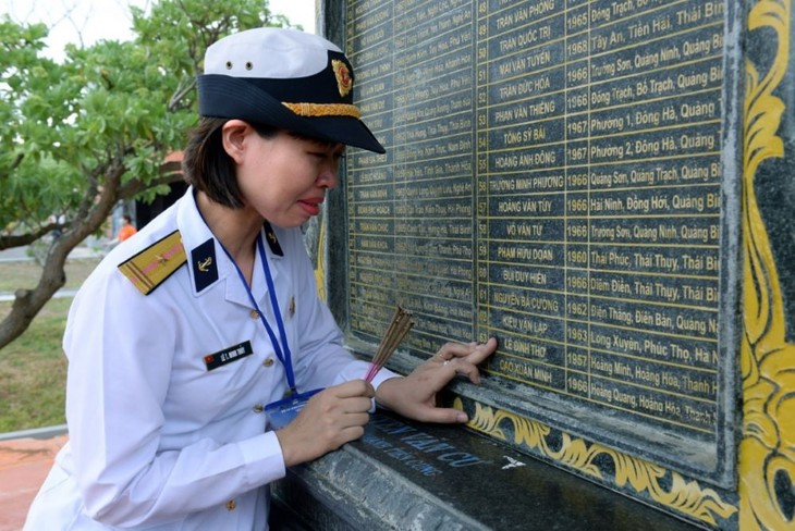 Major Le Thi Minh Thuy visits the Truong Sa archipelago and burns incense for her father and his comrades in arms. (Photo: VOV) Major Le Thi Minh Thuy visits the Truong Sa archipelago and burns incense for her father and his comrades in arms. (Photo: VOV) |
Thuy taught herself English and has mastered new software like Arcgis and Paperchat Composer. She is a pioneer of digital map editing.
“Thuy has done an outstanding job with every assigned task. She is enthusiastic and eager to learn new things, knowledgeable about mapping, and a competent worker. Thuy was put in charge of many important projects, including the national marine planning project, and the project on seabed topographic maps,” Major Nguyen Van Dung, head of the Map Editing team, said.