(VOVWORLD) - The Ho Chi Minh Trail, also known as the Truong Son Trail, along the Truong Son mountain range was a strategic transportation route from the northern rear to the southern battlefield. The trail stretches thousands of kilometers from Nghe An to Binh Phuoc province. For 60 years the trail named after Vietnam’s great leader President Ho Chi Minh has been an artery of Vietnam’s defense and development.
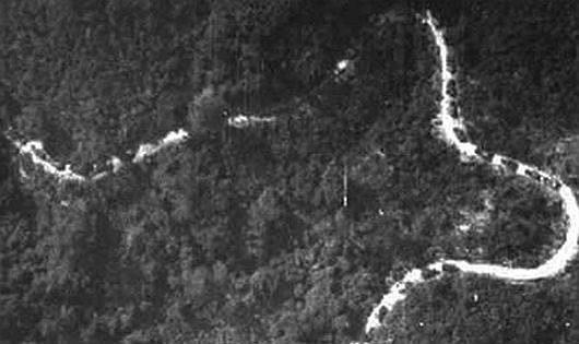
 A part of the 17,000-kilometer trail through the Truong Son mountain raign is seen from above. (Archives photo) A part of the 17,000-kilometer trail through the Truong Son mountain raign is seen from above. (Archives photo) |
In January, 1959, at a meeting chaired by President Ho Chi Minh in Hanoi, the Party Central Committee decided to simultaneously fortify the northern army and open a strategic military transportation route through the Truong Son range to supply the southern battlefield. Four months later, a task force was set up to clear the route and transport military supplies, soldiers, and information between the north and the south. After two weeks, they received an order to deliver military supplies and 500 cadres as quickly as possible to create a core force in southern Vietnam.
The task force was named the 559 Battalion and observed May 19, the birthday of President Ho Chi Minh and the day it was assigned its first urgent task, as its traditional day. Major General Nguyen Ba Tong, former Deputy Commander of the 559 Battalion, said: “The legendary Ho Chi Minh trail was built with the blood, sweat, and tears of the Truong Son soldiers. More than 200,000 officers and soldiers sacrificed their lives on this road axis. The leadership of the Party and Defense Ministry created the best possible conditions and boosted the morale of the troops to accomplish their tasks.”
The trail’s starting point is in Lat village, Tan Ky district, Nghe An province and is marked by the milestone “Kilometer Zero”. The 17,000 km axis had five road systems and 21 cross roads connecting the areas east and west of the Truong Son range.
“The legendary Ho Chi Minh Trail is of great historical importance. The difficult tasks performed along this road were products of the determination, the unyielding spirit, and the wisdom of the Vietnamese people, many of whom were from ethnic minority groups. They devoted their youth to the resistance war against the Americans to liberate the south and reunify Vietnam,” said Doan Van Ky, Deputy Head of the Commission for Communications and Education of the Party Committee of Dak Nong province, where the trail run through.
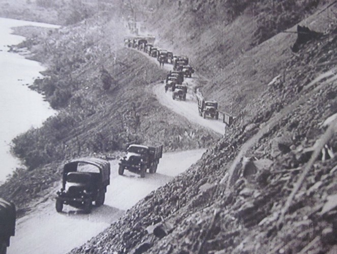
 Army vehicles parade through the Ho Chi Minh Trail. (Archives photo) Army vehicles parade through the Ho Chi Minh Trail. (Archives photo) |
Before Vietnam was reunified in 1975, more than a million tons of weapons and supplies and two million soldiers and cadres had been transferred from the north to the southern front. After the 1973 Paris Accord was signed, ending the war and restoring peace in Vietnam, the Truong Son troops began to upgrade the eastern Truong Son road, from Nghe An to Binh Phuoc province, to a national public highway. According to Major General Tong, former Party General Secretary Le Duan once called the Ho Chi Minh Trail a key to Vietnam’s liberation and future development.
“The Ho Chi Minh Trail facilitates travel along the Truong Son range, thereby promoting economic activity and improving people’s lives. It plays an important role in Vietnam’s defense and development today,” Tong said.
The Ho Chi Minh Trail was the trail of national reunification. Its construction and exploitation was one of Vietnam’s most successful war tactics.