(VOVWORLD) - Typhoon Yagi is currently moving through the Gulf of Tonkin at a speed of 15-20 km/h, maintaining its intensity at level 14. It is forecasted to make landfall in the Quang Ninh - Hai Phong on Saturday afternoon.
 In Co To, heavy rain and strong winds caused trees to fall on the roadside. Wind gusts of level 15 is reported from the East- Northeast )(Photo: Tien Cuong/VOV) In Co To, heavy rain and strong winds caused trees to fall on the roadside. Wind gusts of level 15 is reported from the East- Northeast )(Photo: Tien Cuong/VOV) |
According to the National Center for Hydro-Meteorological Forecasting, as of 6 a.m. September 7, the storm's center had winds of 166 km/h (level 14), with gusts up to three levels higher. At that time, the storm was about 160 km off the coast of Quang Ninh and Hai Phong, moving west-northwest at 15-20 km/h. It is expected to make landfall in the afternoon with winds of level 11-12.
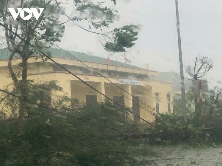
As the storm moves inland, it will hit the Northeast with winds of level 11 and gusts up to level 13, persisting until the evening. The meteorological agency recorded strong winds of level 11 and gusts up to level 13 on Bach Long Vi Island (Hai Phong) and winds of level 6 with gusts of up to level 10 on Co To Island (Quang Ninh).
 Hoang Phuc Lam, Deputy Director of the National Center for Hydro-Meteorological Forecasting reports on the developments of the typhoon (Photo: Nguyen Hai/dantri.com.vn) Hoang Phuc Lam, Deputy Director of the National Center for Hydro-Meteorological Forecasting reports on the developments of the typhoon (Photo: Nguyen Hai/dantri.com.vn) |
Hoang Phuc Lam, Deputy Director of the National Center for Hydro-Meteorological Forecasting, said: "We still identify Quang Ninh and Hai Phong as the primary centers for strong winds. These areas also face a level 4 natural disaster risk. For other inland regions like Thai Binh, Nam Dinh, Ninh Binh, and Thanh Hoa, the natural disaster risk is likely to be at level 3."
From today through September 9, the Northern region and Thanh Hoa province are expected to have 100-350 mm of rainfall, with some areas seeing more than 500 mm. The heaviest rains will occur in the Northeast on Saturday and Sunday, potentially leading to flooding in low-lying areas, flash floods in small rivers and streams, and landslides on steep slopes.
Bracing for the typhoon, the Department of Dyke Management, under the Ministry of Agriculture and Rural Development, reported that as of Friday night, more than 37,000 people in Quang Ninh, Hai Phong, Thai Binh, Nam Dinh, and Ninh Binh had been evacuated to safe shelters. Thai Binh had the highest number of evacuees, with more than 21,000 people, followed by Hai Phong, Quang Ninh, Ninh Binh, and Nam Dinh. the coastal border forces provided warnings and guidance to over 51,000 ships and 220,000 people to help them take preventive measures.
Sea bans were enforced from Quang Ninh to Quang Binh on Friday, while cities like Hanoi and Hai Phong evacuated more than 3,000 residents from hazardous apartment buildings to temporary shelters ahead of the storm's arrival.