(VOV) - The authorities of Thua Thien–Hue province have displayed maps demonstrating Vietnam’s sovereignty over Hoang Sa and Truong Sa archipelagos at historical sites, the railway station, and the city square. Cao Chi Hai, Deputy Director of the Thua Thien – Hue Department of Culture, Sports, and Tourism, says the program’s aim is to inform tourists of Vietnam’s sovereignty over the two archipelagoes. "The provincial Department of Culture, Sports, and Tourism has cooperated with local agencies to introduce national sovereignty, especially sea and islands sovereignty and sovereignty over the Truong Sa and Hoang Sa archipelagoes, to the public. The maps are posted in crowded places to teach foreign tourists about Vietnam’s national sovereignty." Hai said.
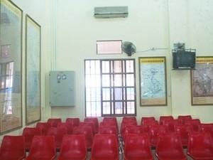
Four maps placed on walls of Hue railway station (Source: VNA)
|
The maps can be seen at the Hue’s Forbidden City, the Revolutionary History Museum, the Thua Thien–Hue Culture and Information square, and the Hue railway station. The large-scale maps include an 1834 map of Vietnam from the King Minh Mang era, an 1838 map of the empire of An Nam, a map of all Chinese provinces published in 1904 by China’s Qing dynasty, and a 1940 Map of Indochinese weather stations.
All of the maps have captions in Vietnamese, Chinese, and English.