







(VOVworld) – The Hoang Sa District People’s Committee has 91 original foreign maps proving Vietnam’s sovereignty over the Hoang Sa (Paracel) and Truong Sa (Spratly) archipelagos. The maps, donated by Vietnamese-American Tran Thang, were published in several Western countries between the 16th and 19th century. The committee also received a magazine of the British Royal Geographical Society, a Chinese mineral magazine published in the US, and three atlases which identify the archipelagos as belonging to Vietnam.
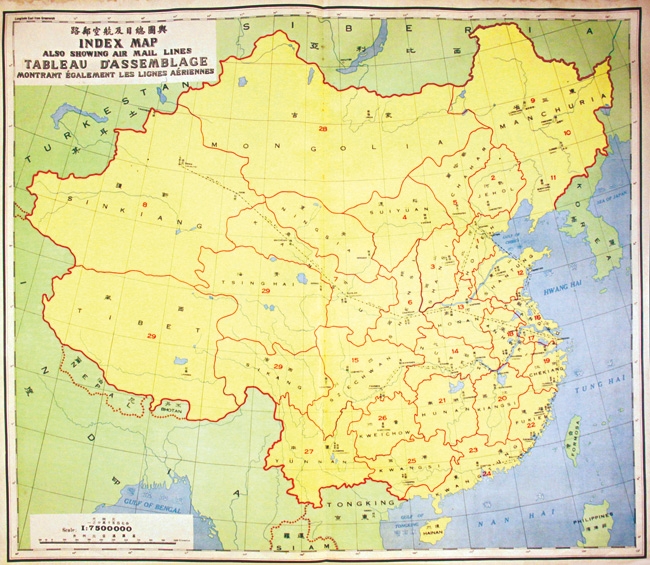 |
| Postal Atlas of China published in 1933 shows China's territory stretching as far as Hainan island (Photo: danangcity.gov.vn) |
The evidence will be preserved by the Da Nang museum and put on display at Da Nang, Thua Thien-Hue, Ho Chi Minh city, and Khanh Hoa province during the ‘Sea and Islands Week' to be held next year.


