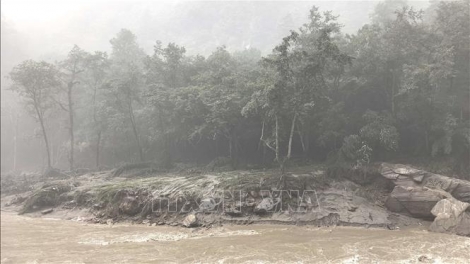




According to Nepal’s National Disaster Risk Reduction and Management Authority, a preliminary analysis of satellite images from Planet Labs shows that a large mass of ice and rocks slid down an area about 20 kilometres northeast of the Rasuwagadhi border crossing, near the Nepal-China border.
The debris flowed into the Lhende Khola River, causing floodwaters to sweep through the Timure area and into the Bhote Koshi River before continuing downstream into the Trishuli River.
Nepal’s Department of Hydrology and Meteorology said satellite images provided by China, taken before and after the disaster, showed that the landslide of ice, soil and rocks had blocked the Lhende Khola River, forming a temporary lake upstream. When the natural dam became unstable and collapsed, the accumulated water was suddenly released, carrying large amounts of mud, rocks and other debris downstream and creating a highly destructive flood.
Nepal’s meteorological authorities didn’t record heavy rainfall in the Rasuwa area on Tuesday and Wednesday. Another factor being examined is a magnitude 4.4 seismic signal recorded around the time of the disaster.
However, the US Geological Survey later said this was unlikely to have been an earthquake, but rather a seismic signal generated by the collapse of the huge mass of ice and rocks and the flow of debris down the valley.
The international community is urgently stepping up support for Nepal. Stéphane Dujarric, spokesperson for the UN Secretary-General, said: “In Nepal, we, along with our humanitarian partners, are coordinating the relief efforts. This is being done in support of the government-led response in an effort to meet what will clearly be massive humanitarian needs. Two staff from the World Health Organization are already on site with enough medical kits for about 10,000 people for three months, as well as tents and logistics support. Starting tomorrow, the World Food Programme and UNICEF are also deploying staff and trucks carrying relief supplies.”
The US said it will send 500,000 USD in emergency assistance for Nepal and deploy a disaster response adviser to the affected area. The EU has activated the Copernicus satellite monitoring program to “help map the affected areas in Nepal and support the response on the ground.”